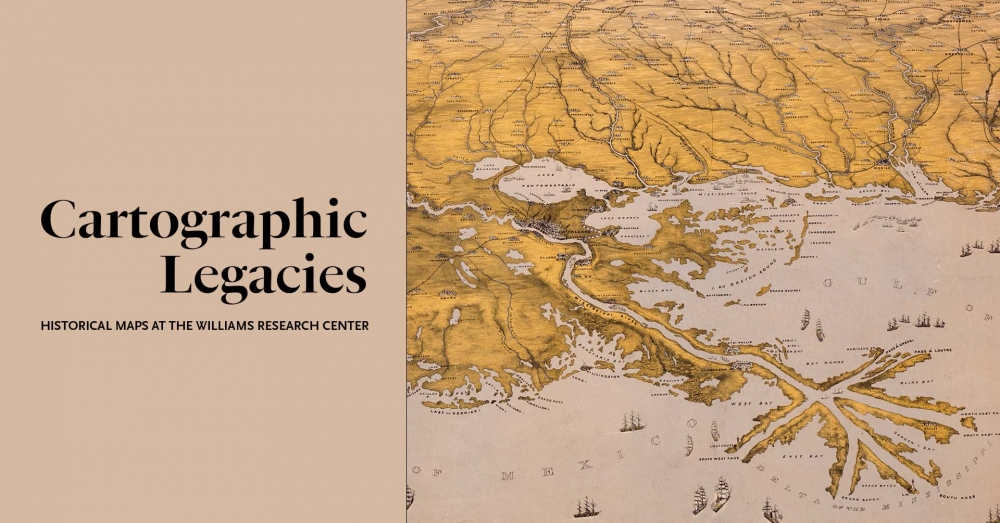
Maps are more than visual representations of landscapes and geographic features; they’re also storytellers. Cartographers imprint their views of the world on the maps they make, leaving significant messages in tiny details.
In this series of videos, The Historic New Orleans Collection’s Chief Curator Jason Wiese demystifies some of the museum’s most significant maps. Wiese curated the exhibition Cartographic Legacies: Historical Maps at the Williams Research Center and was a key contributor to THNOC’s landmark 2003 publication Charting Louisiana: Five Hundred Years of Maps.
Together, the videos present stories that emerge from the lines of these documents, including sea monsters, a novel 19th-century invention, a foundational French chart that miraculously survived both fire and the ravages of time, and a two-sided look at the Battle of New Orleans.
1. A (new) world of cartography
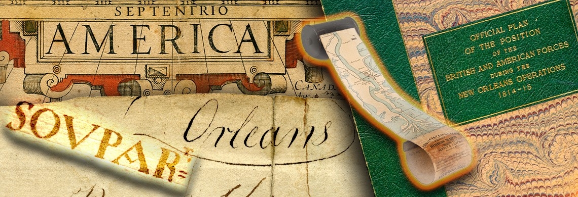
The map "America," produced between 1606 and 1619, includes details like a Japanese ship, sea monsters, and an inset illustration of Indigenous people mixing an intoxicating beverage. Scenes like these were intended to increase the marketability of the map to European audiences who were fascinated with the Americas.
2. Rolling down the river
In the 1860s, two inventors came up with a nifty solution to fit a map of the entire Mississippi River into a traveler's pocket. The ribbon map included a hand-cranked spool that could wind the 12-foot-long canvas into a small carrying case. Wiese talks through the practicality of this artifact and how it stands out as a curious piece of 19th-century Americana.
3. Copycat cartography
More than 300 years ago, a French marine pilot spent months on a ship navigating the northern Gulf Coast, carefully charting the land and water features in a hand-drawn map. That very document went on to influence more than a century of western cartography. This video highlights this foundational document of French knowledge in the new world and reveals the story of an artifact, with its edges charred from a shipboard fire, that survived against all odds to the present day.
4. Both sides of the battle
In the weeks before British and American forces clashed in Louisiana in 1814 and ‘15, a British officer, disguised as a fisherman, was scouting a way for his fellow redcoats to capture New Orleans. In the ensuing series of engagements, John Peddie meticulously noted the movements and actions of both sides in the conflict, and his resulting map is a colorful account of the Battle of New Orleans. This map, paired with another manuscript sketch from the American perspective, gives insight into one of the most significant military victories in the history of the United States.
For more on historic Louisiana maps, visit Cartographic Legacies at 410 Chartres Street.