 Explore the maps by zooming in
Hover your mouse to zoom in on the maps. Use your mouse wheel to zoom in and out.
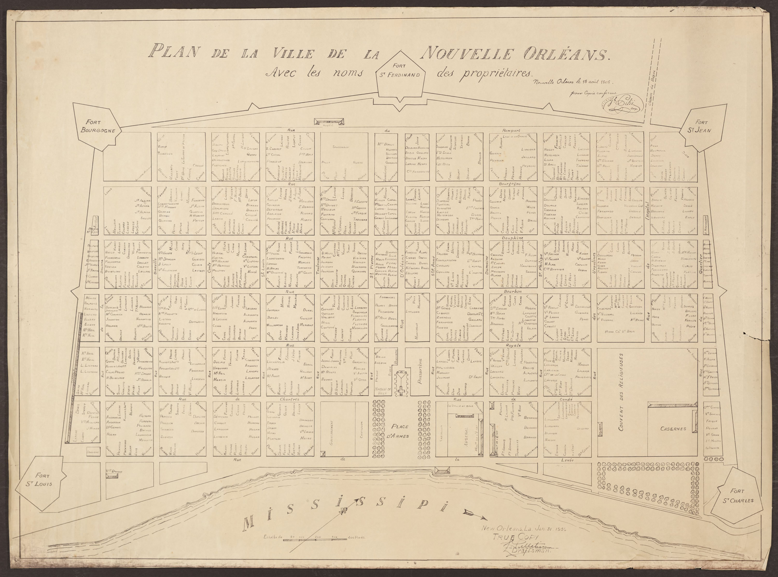
ID: 2008.0001.3
Title: Plan de la Ville de la Nouvelle-Orléans avec les noms des propriétaires (pour copie conforme
Date: August 18, 1808
Creator: Joseph Pilié - surveyor
Courtesy of: The Historic New Orleans Collection (Publication may be restricted)
Provenance: The Historic New Orleans Collection
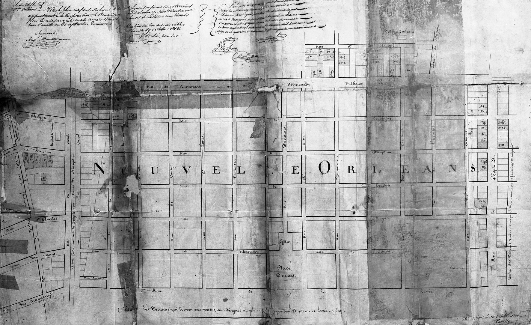
ID: N-770
Title: [Plan de la Nouvelle-Orléans]
Date: December 16, 1816
Creator: Jacques Tanesse - City Surveyor
Courtesy of: The Historic New Orleans Collection (Publication may be restricted)
Provenance: Vieux Carre Survey Archive
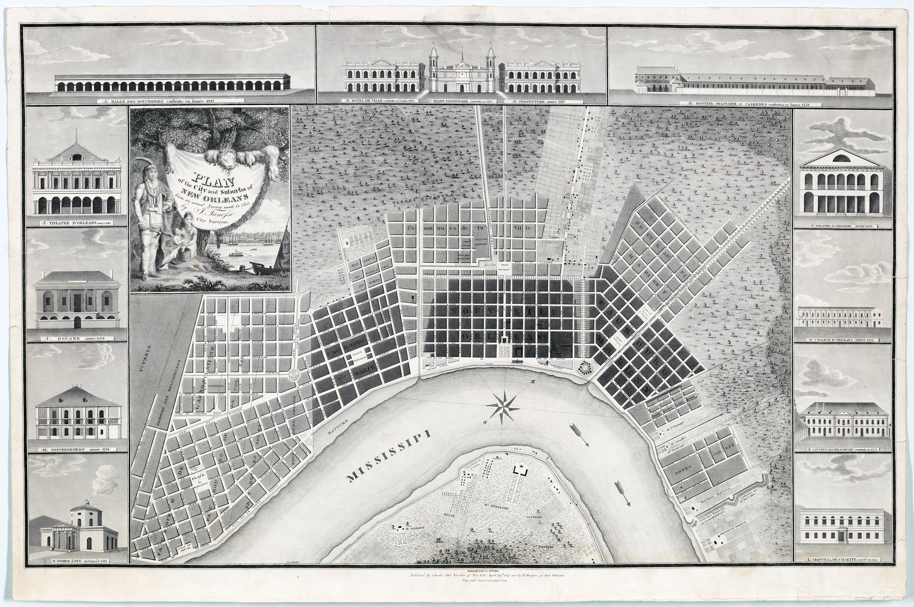
ID: 1971.4
Title: Plan of the City and Suburbs of New Orleans from an actual survey made in 1815 by J. Tanesse City Surveyor
Date: April 29, 1817
Creator: Jacques Tanesse (original) - City Surveyor
Courtesy of: The Historic New Orleans Collection (Publication may be restricted)
Provenance: Published by Charles Del Vecchio of New York and P. Maspero of New Orleans, April 29, 1817. Engraving at The Historic New Orleans Collection
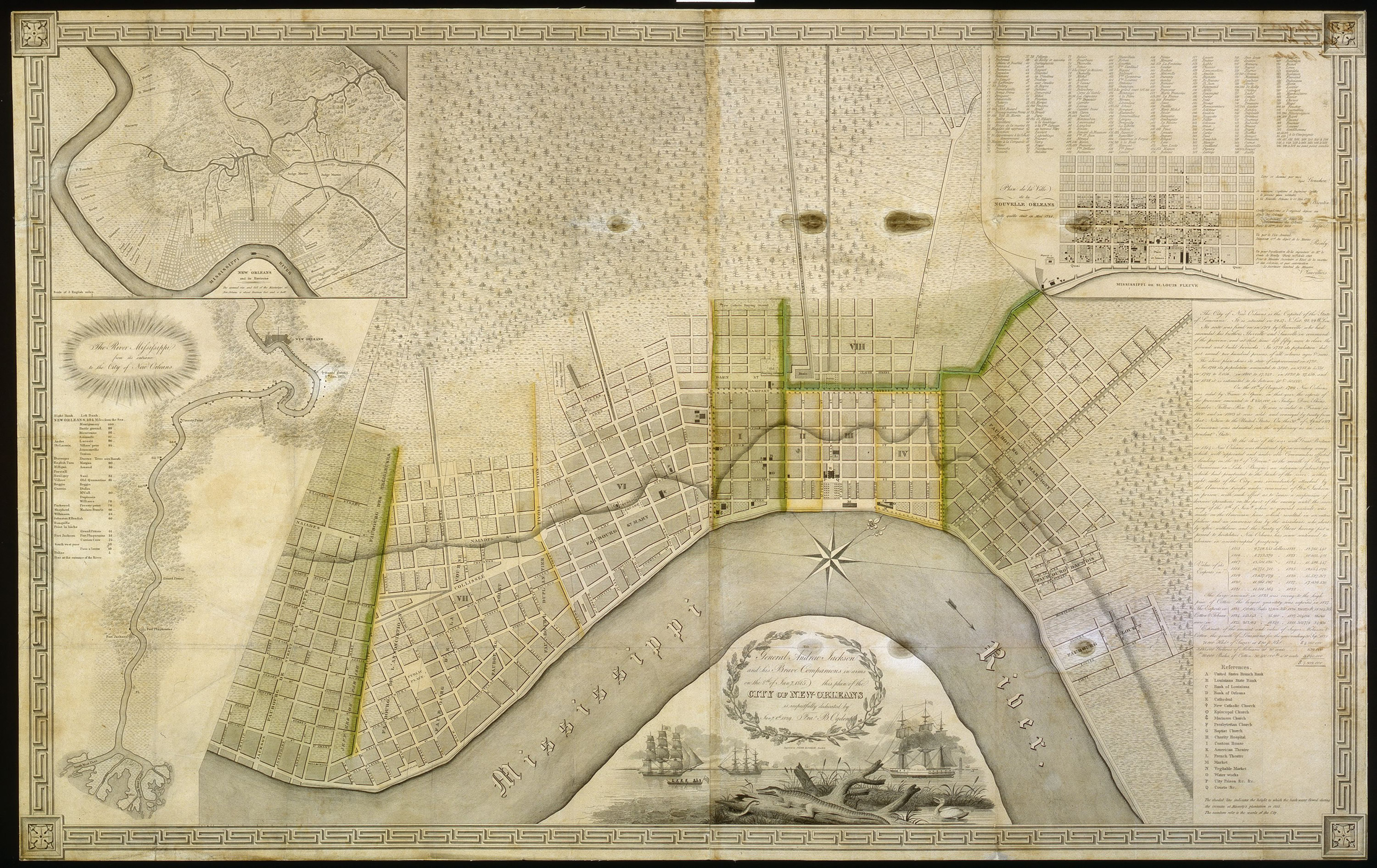
ID: 1971.21
Title: City of New Orleans
Date: January 8, 1829
Creator: Francis B. Ogden (Peter Maverick, New York - engr)
Courtesy of: The Historic New Orleans Collection (Publication may be restricted)
Provenance: The Historic New Orleans Collection
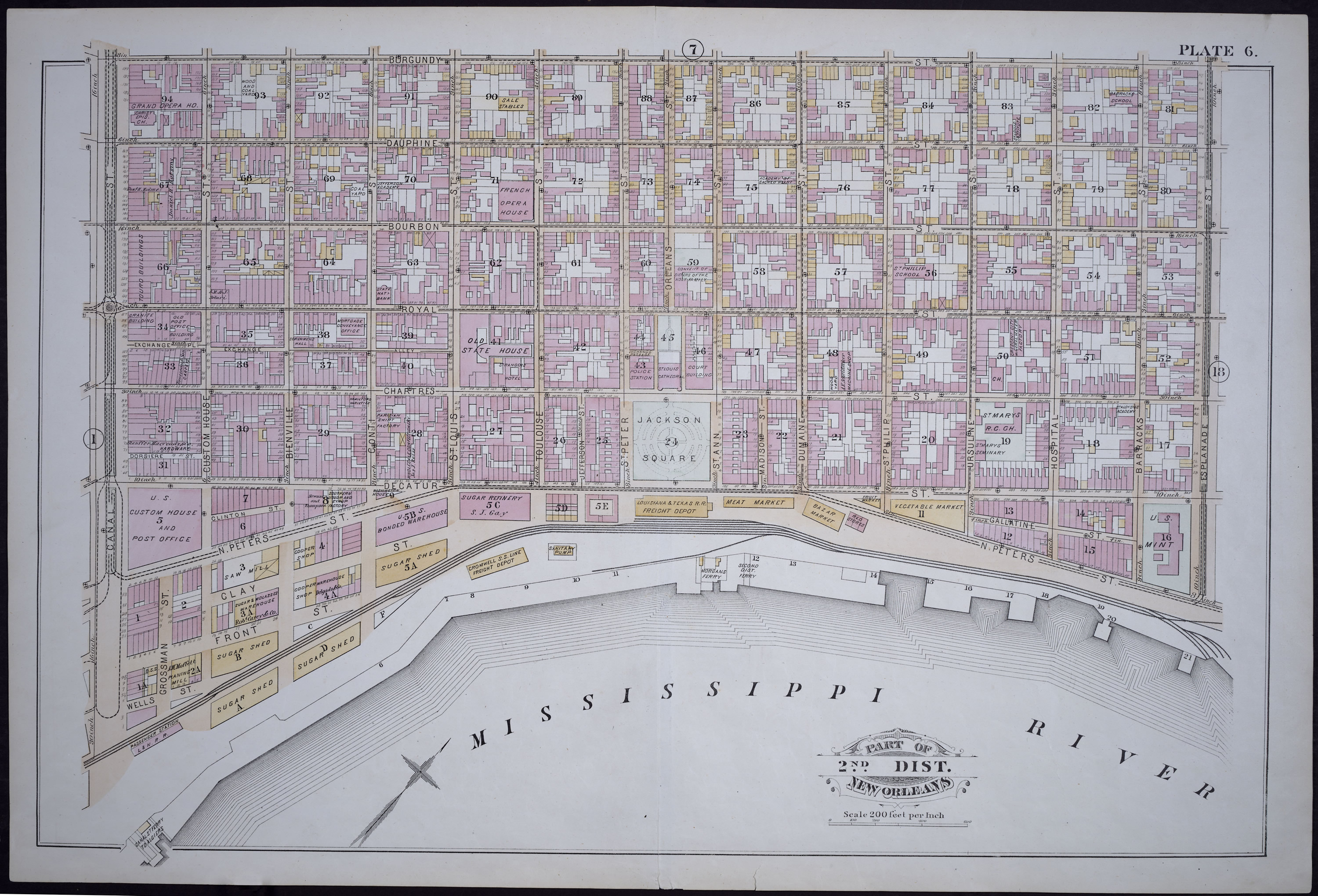
ID: 1952.8.8
Title: Atlas of the City of New Orleans Louisiana (Robinson Atlas) - Plate 6, Part of 2nd District New Orleans
Date: 1883
Creator: E. Robinson et al.
Courtesy of: The Historic New Orleans Collection (Publication may be restricted)
Provenance: An original copy, property of The Historic New Orleans Collection
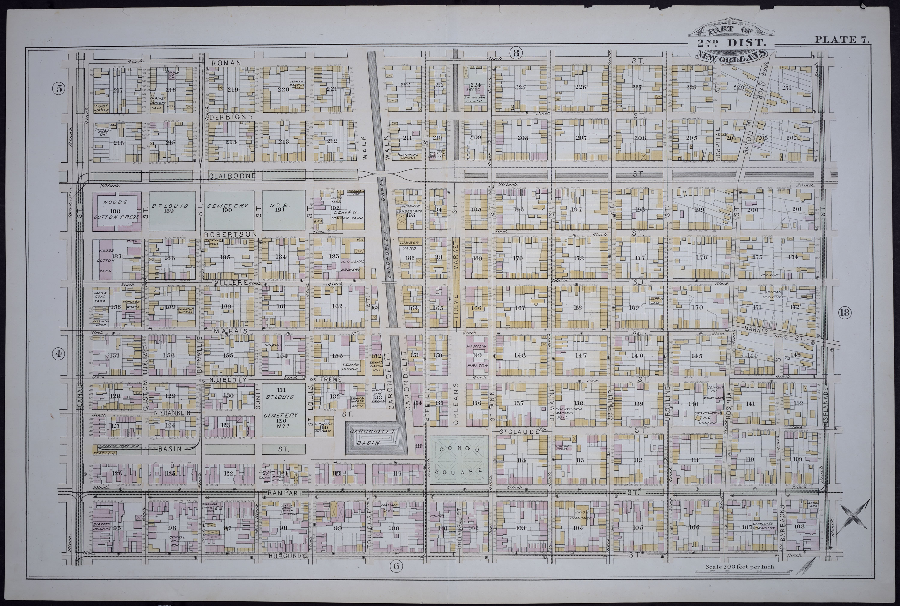
ID: 1952.8.9
Title: Atlas of the City of New Orleans Louisiana (Robinson Atlas) - Plate 7 , Part of 2nd District New Orleans
Date: 1883
Creator: E. Robinson et al.
Courtesy of: The Historic New Orleans Collection (Publication may be restricted)
Provenance: An original copy, property of The Historic New Orleans Collection
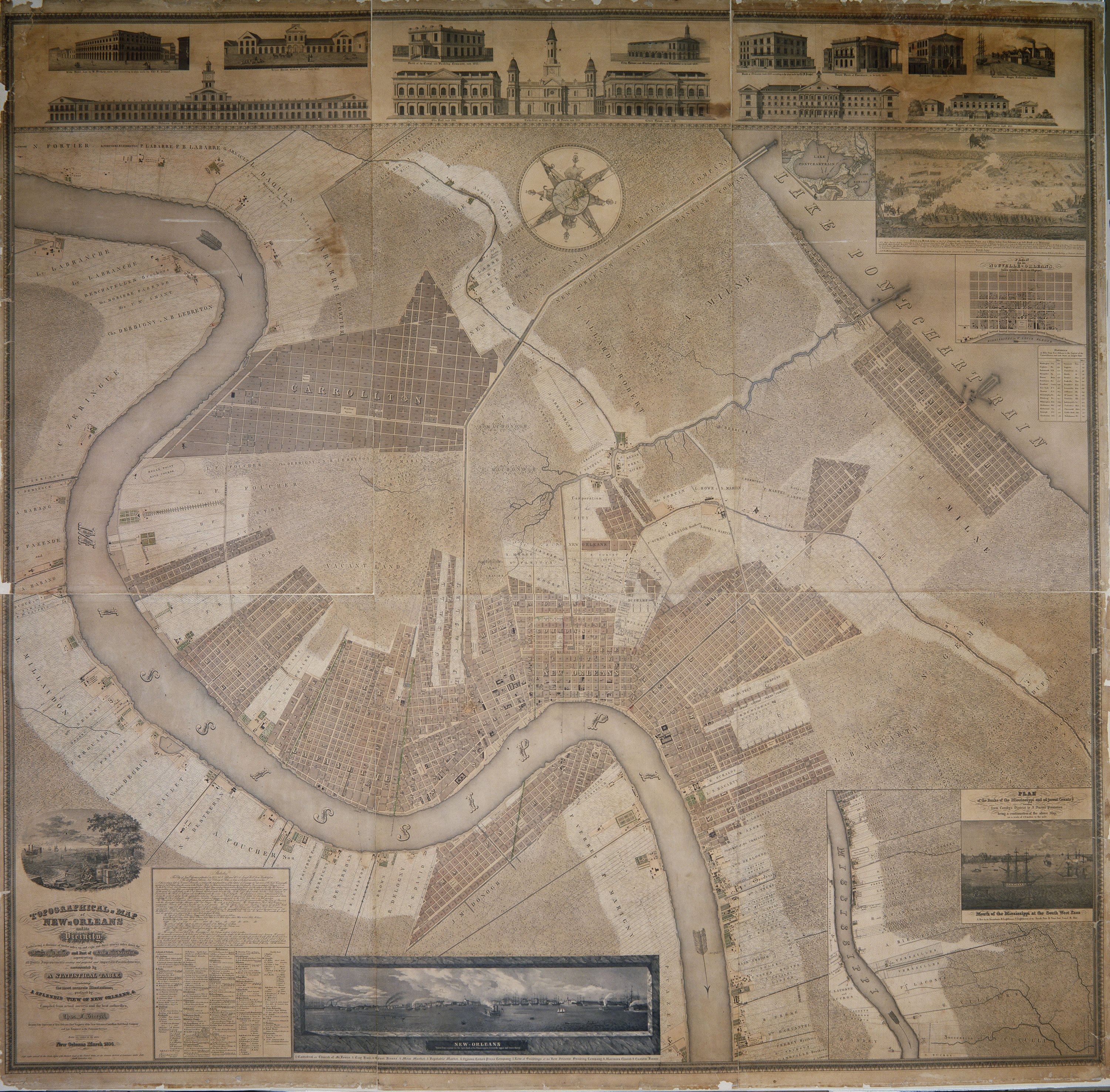
ID: 1945.13 i-xix
Title: Topographical Map of New Orleans and its Vicinity, Embracing a distance of twelve miles up and eight and three quarters miles down the Mississippi
Date: ca. September 4, 1833
Creator: Charles F. Zimpel - surveyor
Courtesy of: The Historic New Orleans Collection (Publication may be restricted)
Provenance: Original at The Historic New Orleans Collection
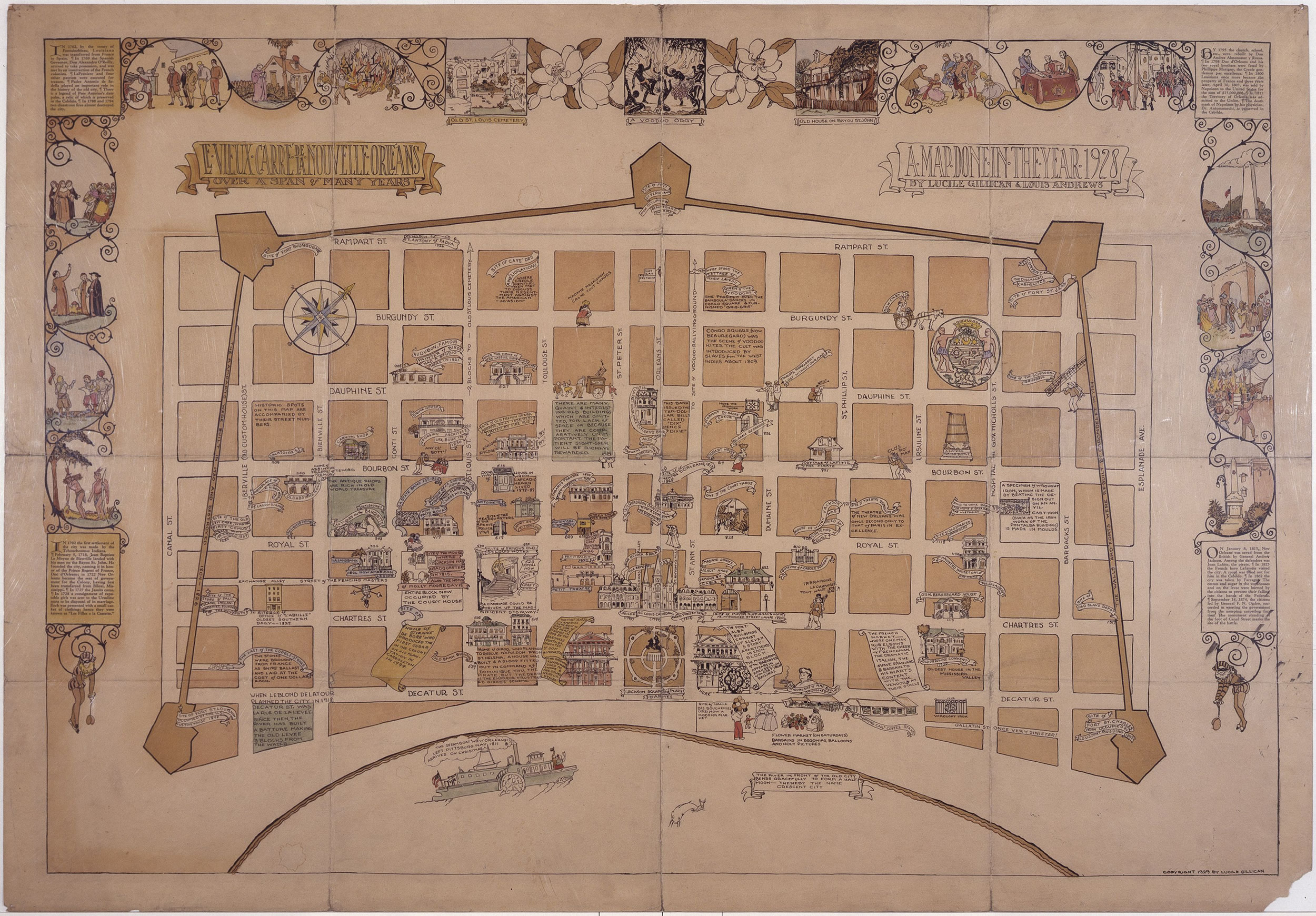
ID: 1951.27
Title: Le Vieux Carre de la Nouvelle Orleans Over a Span of Many Years
Date: ca. 1928
Creator: Lucile Gillican and Louis Andrews
Courtesy of: The Historic New Orleans Collection (Publication may be restricted)
Provenance: The Historic New Orleans Collection
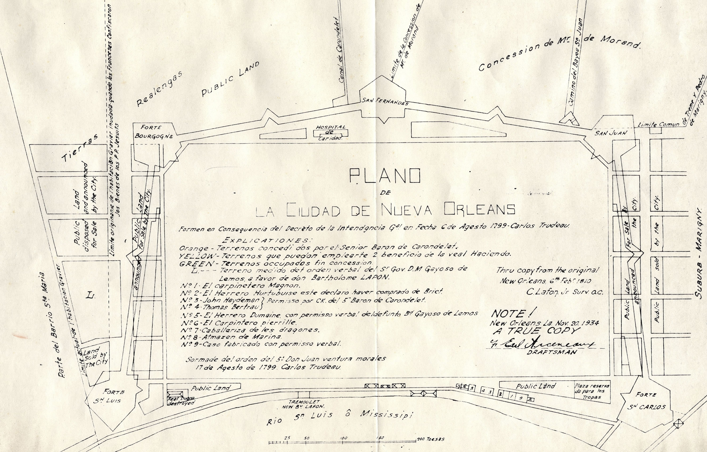
ID: M_2_016_017
Title: Plano de la Ciudad de Nueva Orleans
Date: between 1950 and 1975
Creator: Earl Arceneaux (2nd copy) - draftsman
Courtesy of: The Historic New Orleans Collection (Publication may be restricted)
Provenance: Copy (between 1950 and 1975) of a copy (Nov. 20, 1934) by Earl Arceneaux of a copy (Feb. 6, 1810) by C. Lafon, Jr., Surveyor; original plan by Carlos Trudeau, dated Aug. 6, 1799. Map found in The Historic New Orleans Collection
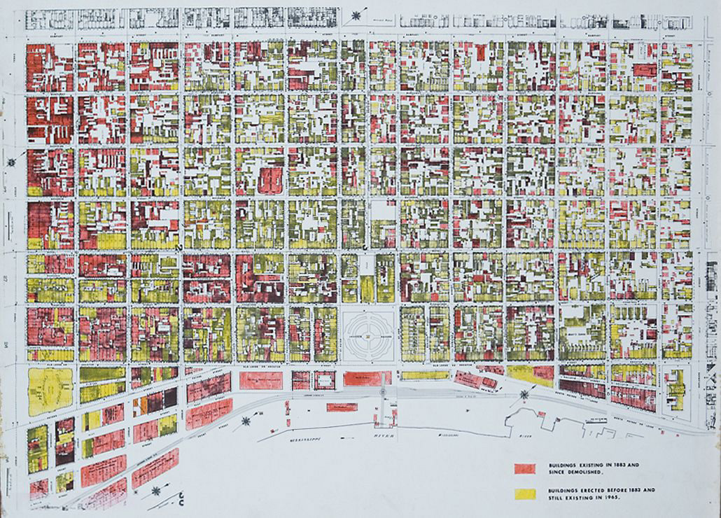
ID: fq_0002_map_FQbldgs
Title: The Vieux Carré - Buildings existing in 1883 and since demolished
Date: ca. 1965
Courtesy of: The Historic New Orleans Collection (Publication may be restricted)
Provenance: Created for an exhibit on historic preservation, property of THNOC Vieux Carré Survey Executive Committee
This project was made possible in part through the generous financial
support of the Collins C. Diboll Private Foundation.
Please direct all inquires and questions to reference@hnoc.org
Contact Us | Terms & Conditions | Privacy Policy